I'd been meaning to ride the Fife coastline for years. Somehow I'd never done it. There was always a better plan. Always something which sounded more fun. I remember reading about it in an old mountain bike guide book. The route was described as a must do for every mountain biker seeking adventure.
I could never correlate that description with what I knew of the coastline from weekend outings in the car. Sure, it was nice and had some nice sandy beaches, but it always seemed a bit busy, both with people, houses and industry. How could this possibly be at the top of any mountain biker's to-do list?
Half way though a busy and stressful week at work, I decided I needed a weekend away. I wanted nothing more than to have a break from normal life and enjoy the freedom that comes from cycling with a lightweight tent and a rough plan. I also didn't want to have to drive far and at first thought I'd go for a ride straight from my house to the hills to the south or west of Edinburgh. But, I'd done that many times before. Instead, I choose to ride straight from my house north. I asked a couple of reliable friends if they'd be up for joining me.
Unfortunately, it was too late in the week, they already had plans.
There is a Fife coast cycle route, but this wasn't what I planned to ride. I was going to try the walking route. A quick trip to shop to buy the relevant OS map and I spent a happy hour examining the paths. The walking route appeared to consist of paths and track-roads following the very edge of the coastline for almost it's entire length. The cycling route mostly follows roads, slightly inland. The walking route looked like it'd be far more challenging, interesting and fun.
And so on a Friday night I was almost ready to go. My bags packed and ready, I checked my bike over, inflated the front tyre a bit and heard an ominous hissing sound. I have a tubeless set-up on this bike so was surprised that even after shoogling the wheel and spinning it, the sealant inside didn't seem to be doing it's job. A search soon found where the air was escaping; a hole next to the valve. After some faffing around and wondering how I could save the trip, I somehow got the hole to seal up by squeezing sealant in down the edge of the valve and tightening the circular ring that holds it in place. It seemed to be holding up. By now it was later than I'd planned to leave. I decided to postpone overnight. If the tyre was still fine in the morning then I'd go, otherwise I'd have to open it up and put a normal inner tube in. An annoying job.
Luckily, when I got up for an early breakfast, the tyre looked fine. I finished my coffee and then dragged my bike down the steps at the front of my house. It was ominously warm and grey outside. The kind of day which was very pleasant but could mean thunder and heavy rain was on the way.
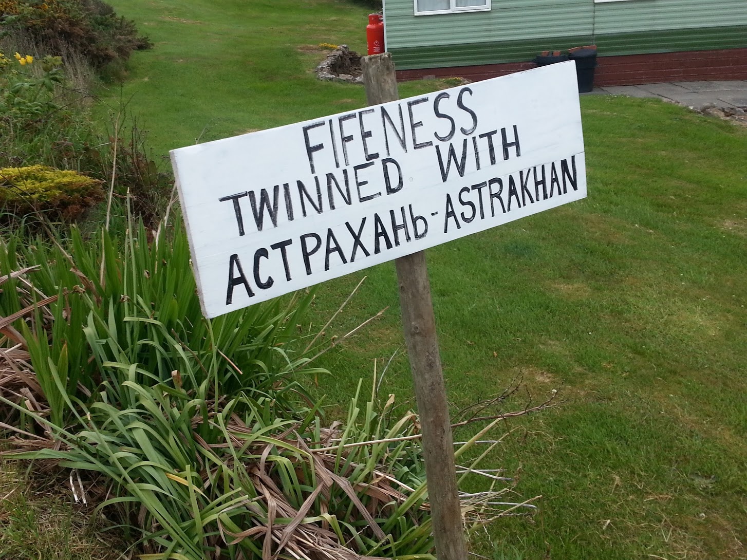
An hour later and I'd left the cycle paths of Edinburgh behind and was crossing the river Forth on the aptly named Forth Road bridge towards the 'Kingdom of Fife'. Once, this area was a separate Pictish kingdom known as 'Fib'. Hence the name, which has stuck despite recent attempts to change it to something more anglican, presumably 'Fife'.
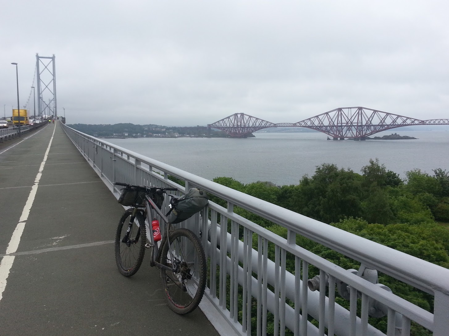
The bridge itself has a nice walk/cycle way along either side which is great. It means you can stop and enjoy the view and stay well clear of the cars and trucks making their way across the river. Upstream, it's possible to see Rosyth Naval docks where they are currently building the HMS Queen Elizabeth, a huge aircraft carrier.
I stopped in the middle, at the highest point after a climb I always find steeper than I expect. The walkway was shaking about quite violently as the heavy trucks passed, a reminder of how I was currently being held in mid air by a less than solid system of cables and lightly constructed surfaces, and a demonstration of how much stress and wear the old bridge is constantly under.
To the west I could see the progress of the new bridge being built to relieve both the current bridge's traffic congestion and the stress on it's old, corroding structure. With fantastic foresight and planning, there is no walkway or cycleway on the new bridge. Presumably that would have cost extra.
Once I rolled down the far side of the bridge, I immediately came to my first steps of the trip. The official cycle route carried on along the road, but I wanted to go down to the walking path in North Queensferry, part of which is literally underneath the end of the bridge. I rolled my laden bike down the steep steps to the road below and continued on down to the pier at the waterfront. I was now on the Fife coast walking route.
It was now 10am. I was keen to get going and start experiencing some new riding.
Heading off, the first short part of the ride was along lovely, grassy, gravelly tracks high above the water. It wasn't to last though. The surroundings soon changed to became quite industrial, the route taking me around a small harbour where a single lonely ship was unloading pallets onto a pier. Next, I was directed onto quiet back roads and then on busy roads through the town centre of Inverkeithing. Here, I was beginning to wonder what I'd got myself into. A car pulled out of it's parking space without looking causing me to swerve dangerously into the road. Another passed literally a few centimetres from hitting my handlebars with it's wing mirror, even though the road was wide and nothing was coming in the opposite direction. Keeping a lookout for the coastal path signs, I was hoping that this was a small detour from the coast. I passed a junction and noticed a possible signpost hidden on the opposite side behind a wall. I backtracked to take a look. Sure enough I was being directed away from the main road. This was going to be tricky, the signs were clearly designed for slow moving pedestrians on the pavement.
The next section was through a housing estate. At least I was on the coast now. The landscape was thus far as grey and heavy as the sky. Still it wasn't raining, and a warm breeze which is rare in these parts was making the actual cycling very pleasant.
I stopped to take a photo at a large pier next to a disused quarry. An elderly group of walkers made their way over.
“Watch out for the glass, you dinnae wana get a puncture!”
“Yeah, unfortunately it's everywhere along here, pretty much unavoidable.”
“You going far?”
“Yes, I think I'm going to try to reach the coast just before St Andrews. You?”
“Ha….no….we're going to stop at the next pub we can find!”
I liked their thinking….their plan sounded pretty good. I wished them a nice walk and cycled onwards.
About a kilometre further and I reached the town of Dalgety Bay where the path had the sea on one side and new build flats and houses on the other. The path was also new. Fresh smooth tarmac eased my progress for a further kilometre until before me opened out the actual sandy bay of Dalgety. It was lovely.
It's here that they seem to keep finding radioactive particles in the sand. 800 war planes with radioactive luminous paint on the instrument dials, were dumped into the sea here. Coastal erosion is bringing the waste up to the surface.
Until a fairly recent deactivation, this was also a location of a relatively secretive Z-berth. This was a designated spot where nuclear warships could berth for operational or recreational visits. A nearby team was at the ready for monitoring the area during visits, responding to emergencies, and in the case of a nuclear accident, handing out copious amounts of iodine tablets to the public.
Cycling along the edge of the bay, there was little visible evidence of the past military history. Half-way around the bay, hidden in a quiet woodland overlooking the water was an old roofless church. I climbed up some stairs of the tower at one end and was rewarded with a nice view over the old cemetery out across the water.
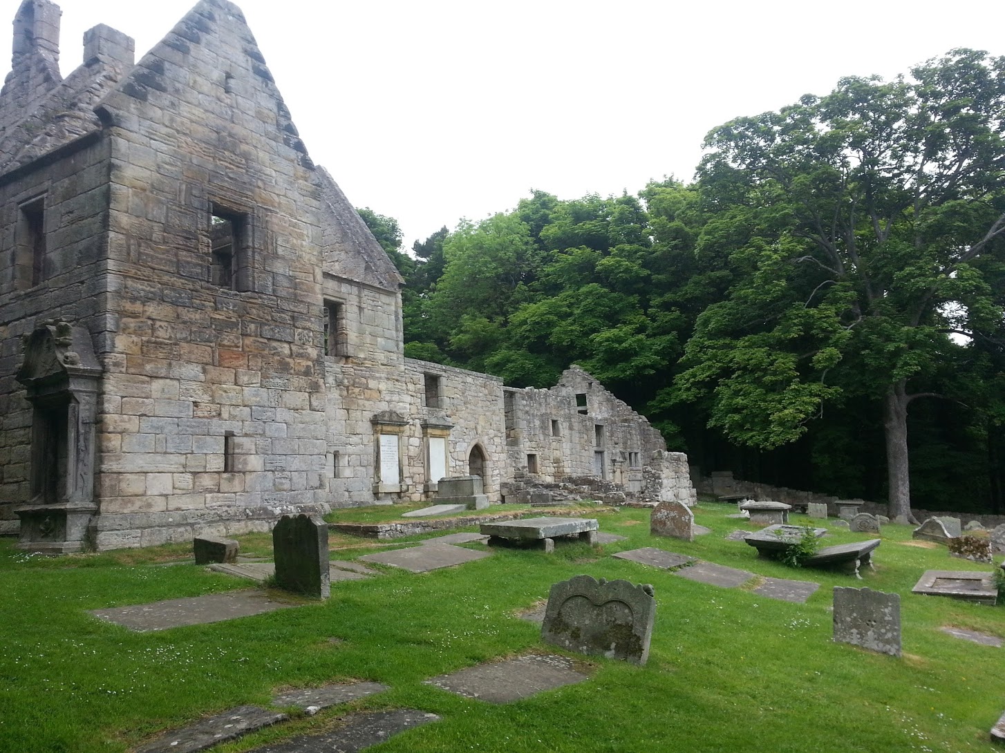
A group of walkers appeared in the main church hall on the ground floor, and after some shuffling about and mumbled chat, started singing. Not hymns either, but proper choir singing. I stayed and listened for ten minutes before quietly making my way back to my bike.
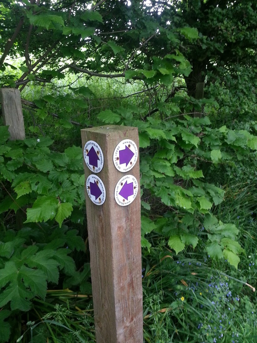
The signposts were directing me up a road heading inland. Looking at the map, it looked possible to continue along the coast for a bit, but I decided to trust the signs. This was a proper detour from the waters edge. I cycled on for a couple of kilometres along tarmac. Several times I came to signposts marking out other walks and had to wonder at their usefullness. At least two of them had four identical arrows pointing in four different directions. What use these could have been to anyone was beyond me. I stopped to take a photo before continuing onwards hoping that I was still going in the right direction.
I popped out at the main street of Aberdour. There's a pretty cool little castle in the middle of town here which is worth a quick visit if you have time. The café was a bit odd though. When I visited, the woman running it was overwhelmed by having two tables of people to look after at once. After curtly telling me to get my own drinks from the unopened drinks packs in the back of a dark cupboard, she dropped a boxful of hundreds of coffee stirring sticks onto the counter in front of us. Rather than just pick them up, she just threw them into the bin in a fit of frustration. Our sandwiches turned up about half an hour later. They were good though!
The signs directed me back off of the main road and along a nice piece of coast. This was followed by a track which took me along the edge of a railway, and then a three kilometre long section on the main road between the small towns of Burntisland and Kinghorn.
From here onwards I'd heard that the route gets progressively nicer. Hoping that the worst of the industrial and road sections were now behind me, I pushed on along a decent path squashed between the railway line and the rocks below.
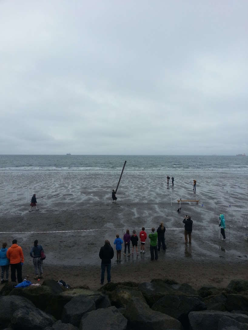
Now I was in the largest town on the coast, Kirkcaldy. I had planned to cycle straight through without stopping, but as I pedalled along the long and exposed promenade I could see some kind of event was taking place half-way along. I passed through a small crowd and peered over the wall down to the beach and saw a man tossing a caber. There was a loud bang and a bunch of runners sett off along the beach, a couple of them falling in the sand before reaching the finishing line. Clearly it was a highland games. I decided to stop and watch for a bit. Noticing the smell of hot food coming from a large van, I looked at my watch to see that it was almost noon. Close enough, I parked my bike and waited in the queue.
Fifteen minutes later I'd had my fill both of food and watching men lobbing big metal balls down the beach.
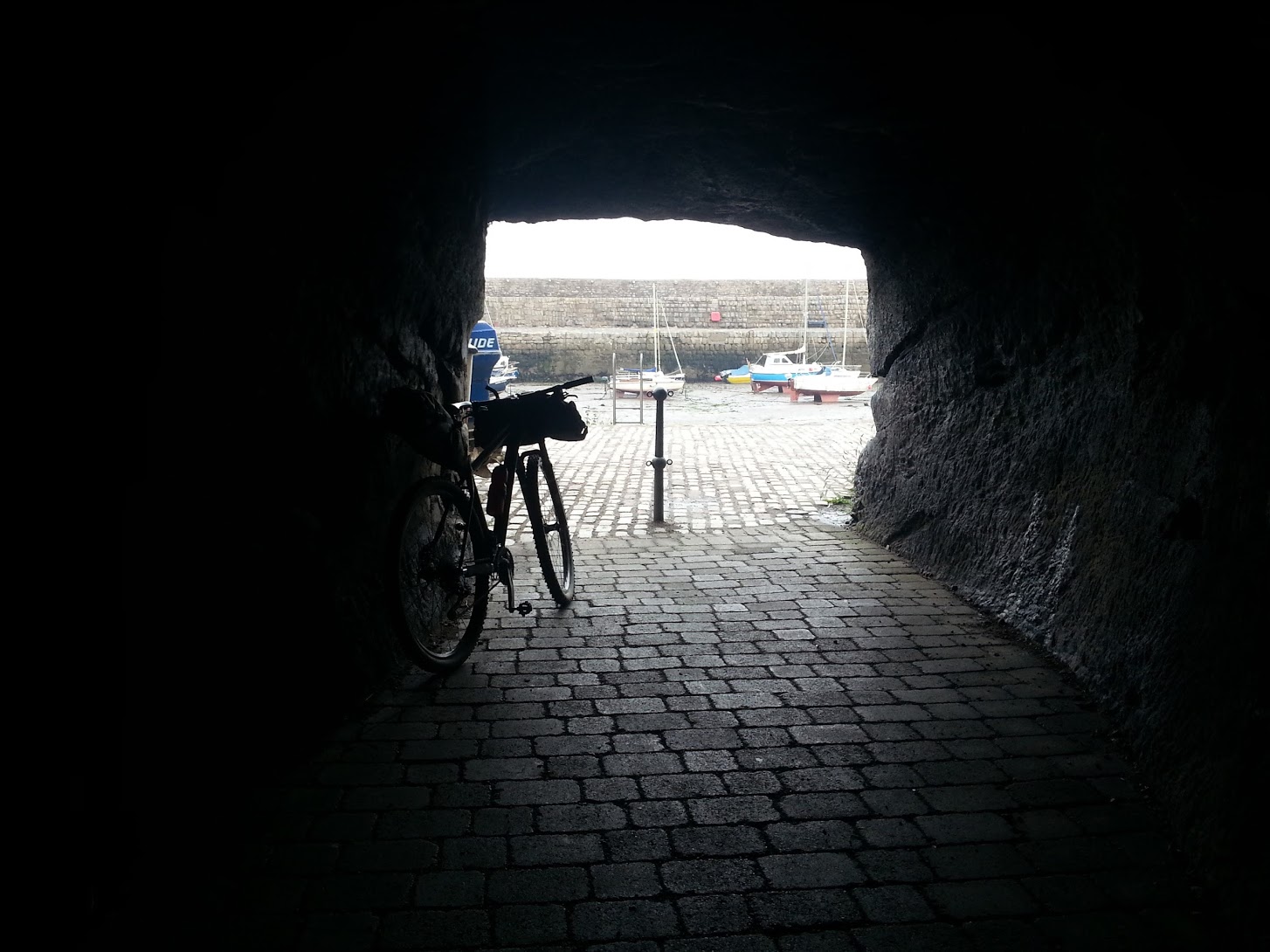
I headed onwards and followed, for the last time, the busy road for a short distance. Cycling through Ravenscraig park was a joy. The sun came out for a time giving a Mediterranean feel to the path as it wove its way past sandy little coves and rocky caves. There was a medieval looking wall along the edge, complete with turreted guard posts. At the far end of the park the path passed through a tunnel under a headland and emerged at the beautiful harbour of Dysart. This really could have been the coast of Italy. Little dinghys were tied up in a bunch by the harbour wall and people were busy on the larger boats or just standing around talking and smoking on the harbour walls.
I passed the aptly named (my surname) 'Blair point' which rather disappointingly wasn't much to look at.
Next came West Wemyss where, after passing the small and pretty harbour which was primarily built to export salt produced by heating sea water over coal fires along the shore, I took a detour down the main street as it looked more interesting than the water front. I found a tollbooth building with tower and gated arch through the middle.
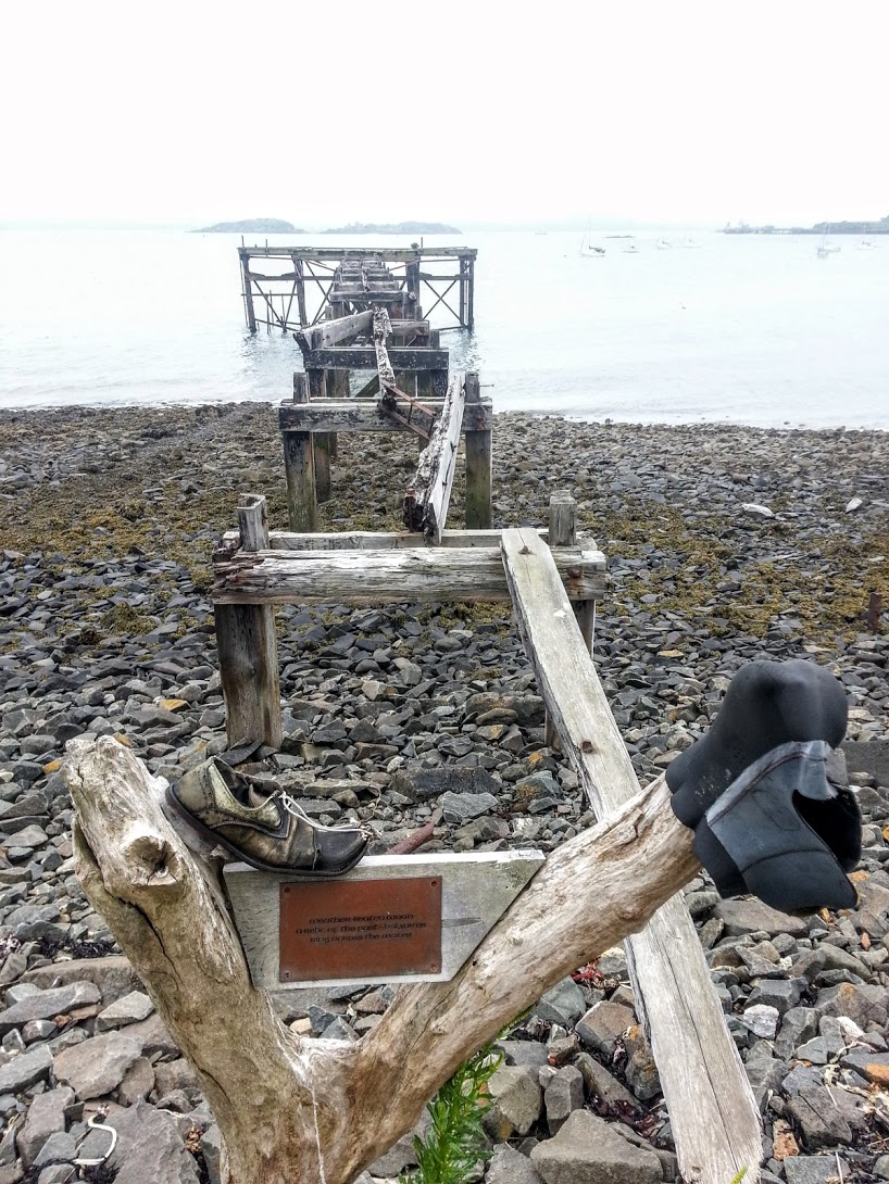
Back down at the sea front I found a granite memorial sculpture of a sea mine. Apparently a mine had appeared in the water nearby in 1941. A group of people, presumably trying to stop it coming closer to the village had tried to move it. It exploded and killed five.
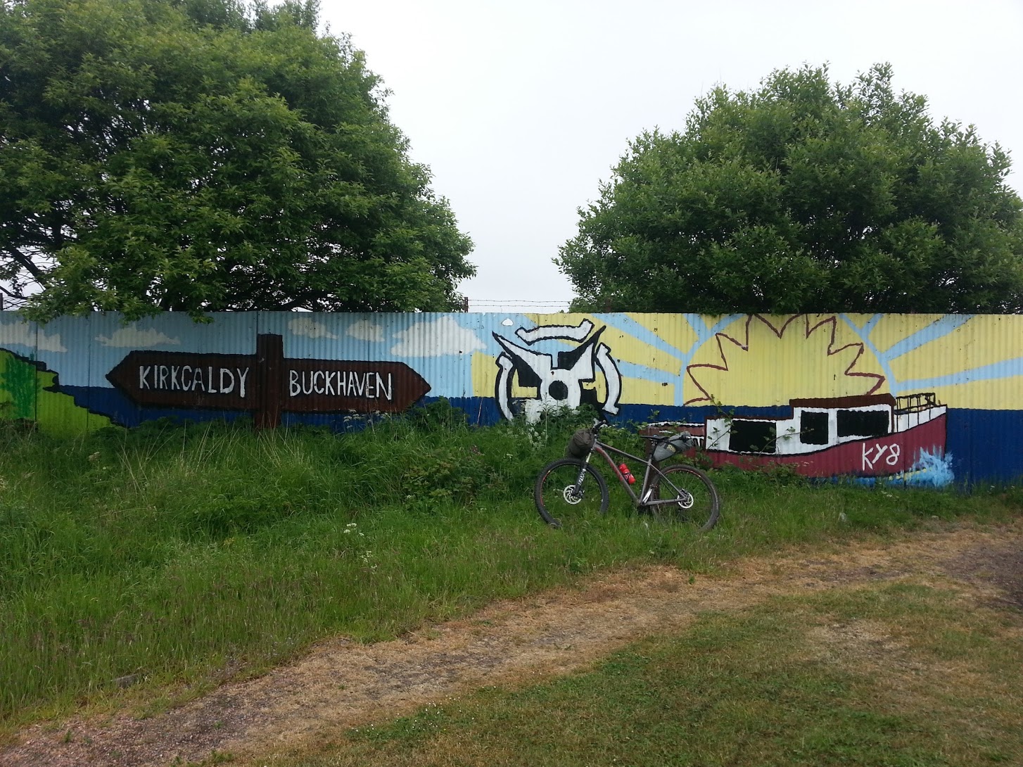
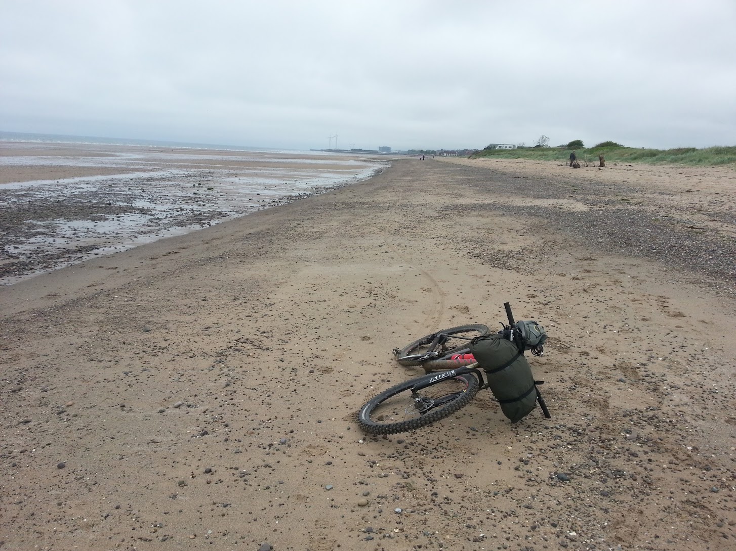
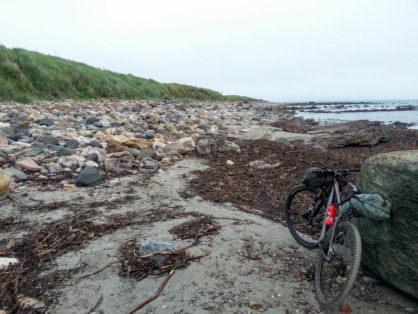
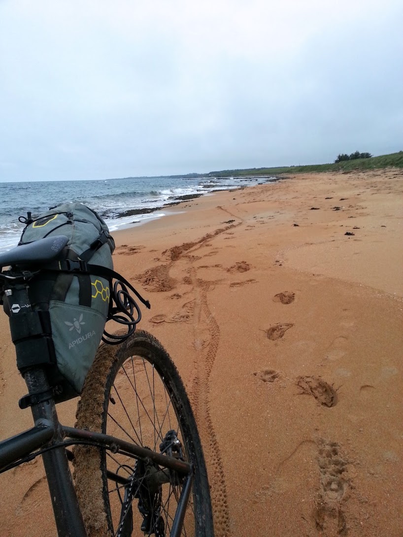
The path returned to gravel along the shore's edge. A short detour along a track road and I found myself in the connected towns of Buckhaven, Methil and Leven. I passed through on quiet roads. It was again quite industrial until I reached the countryside at the far end. Here I was directed towards the beach, avoiding a static caravan park. This was my first bit of beach cycling. While trying not to think too much about the effects of salt on my bike, I pushed over the soft sand at the highest part of the beach. I found it was easy to cycle on the hard sand nearer to the water and made quick progress along the 2km long beach, even including the stops to take some obligatory 'bike on beach' photos. Avoiding the rocks at the far end and rejoining the grassy path at the top of the beach I came to Lower Largo, the birthplace of Alexander Selkirk, the inspiration for Robinson Crusoe. He was an experienced sailor and buccaneer, and while on an expedition off the coast of Chile he left his ship after correctly telling the Capitan that it was no longer seaworthy. He departed on the uninhabited Juan Fernandez islands while they were getting fresh water. He thought he'd quickly be picked up by another passing ship. Instead, for four long years he lived there alone feeling lonely and remorseful, probably quietly sobbing to himself as he stuffed his face with the plentiful lobsters.
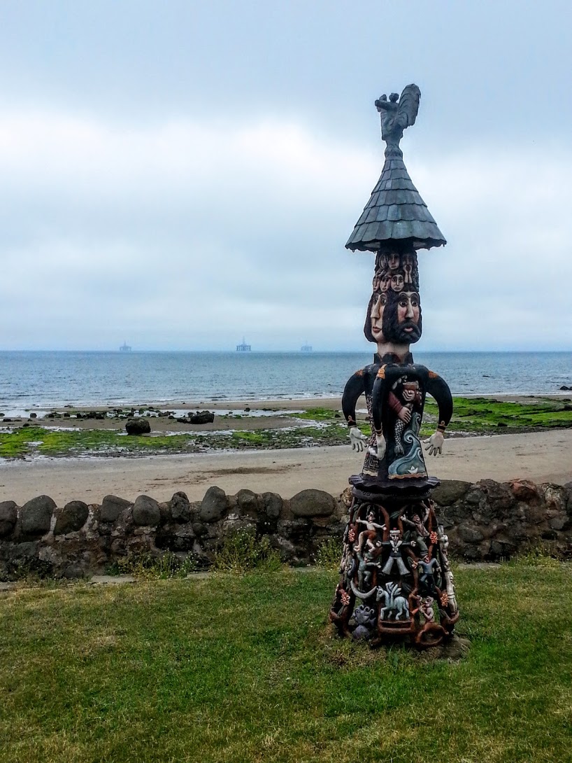
I passed by the Crusoe Hotel on the side of a river, over which the giant arches of a train viaduct loomed. A little further on I came across a house with amazing wood carvings in the garden and on the walls. I stopped to take a closer look. The largest sculpture contained images of the sea, masked figures dancing and climbing. I've no idea what it meant, but I liked it. Looking it up retrospectively, this was 'Malagan' created by the local artist Alan Faulds. He was inspired by a trip to Lithuania where tall wooden sculptures were used to commemorate events such as the deportation of a friend or family member to Siberia.
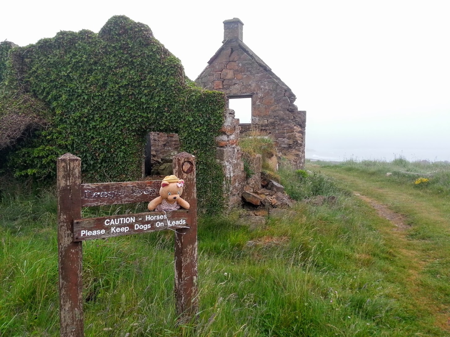
I continued on, past a statue of Selkirk. Where the road ran out, I was directed up some steep steps where I joined the path of an old railway line passing high above the sandy beaches below. A bit further, and I realised the railway was taking me inland. I stopped to check the map. I must have missed a signpost somewhere, the path clearly split from the railway about a kilometre back. I couldn't be bothered returning so instead cut across the sand dunes towards the sea, pushing my bike as I went. I stopped to investigate some WWII pillboxes situated on the higher ground just behind a row of anti-tank blocks. There were a large group of kids with matching neon orange backpacks huddling over a map outside the door of the largest building.
“You alright? Need a hand?”, I asked.
“Yeah…..errmm….where are we?”
I pointed on the map.
“Cool, thanks. So…errrm....is this the coastal path?”
“Yep.”
Good job they were just walking along the coast rather than more difficult terrain such as mountains or forest.
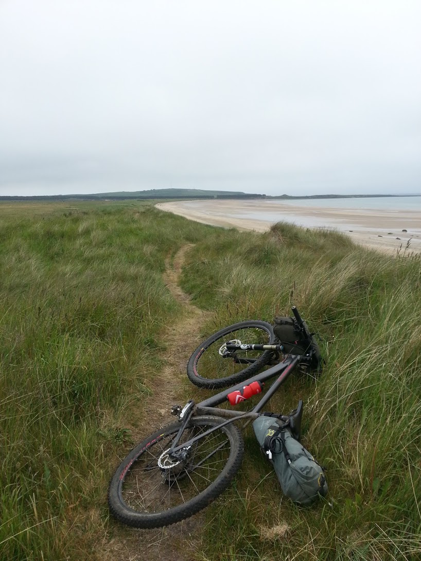
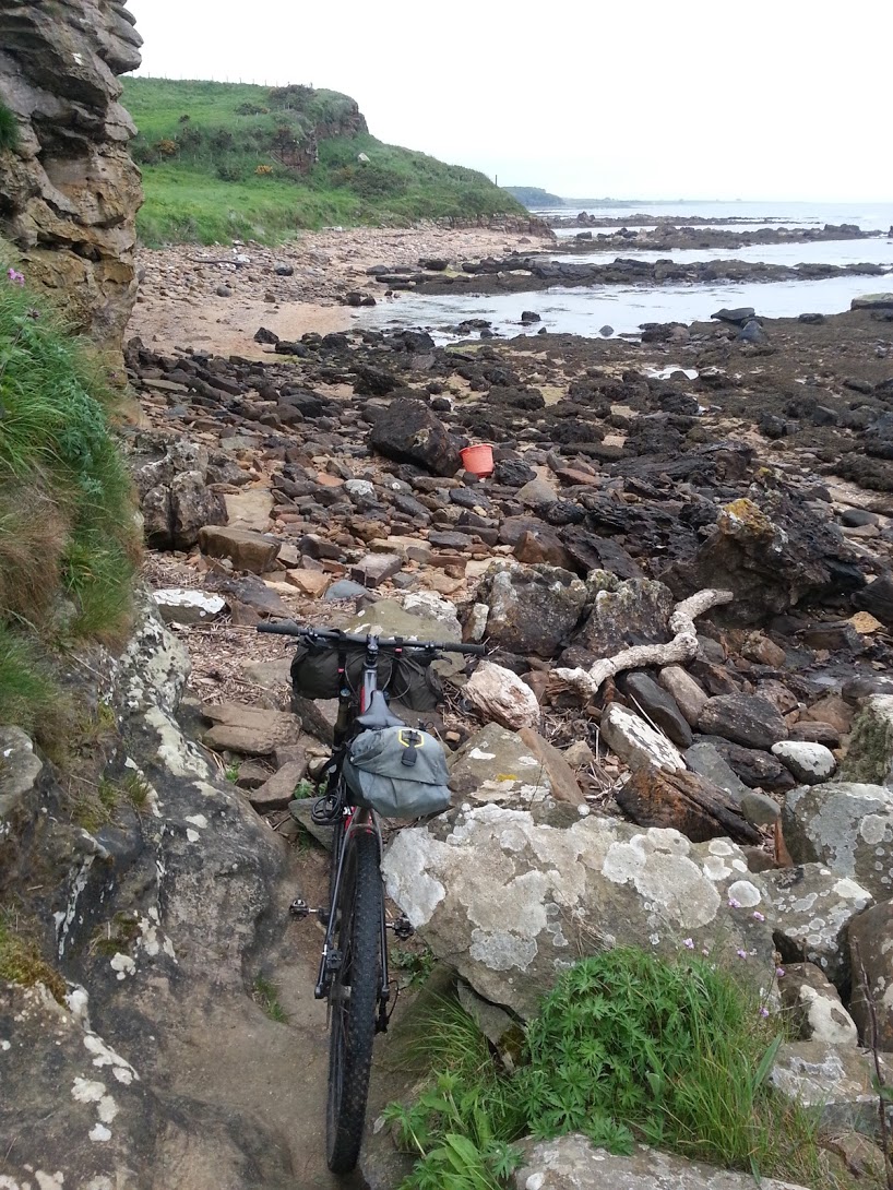
The next section of path was tough going. It took me over, around and between the grassy dunes. The soft sand was almost cyclable but it was hard work to keep the bike moving and often my wheels would slide or lose grip or get bogged down in the sand and I'd have to jump off and push. The long grassy edges of the path meant that if my front wheel moved a little too much to either side it would instantly be swallowed by the undergrowth. For a while it was fun as dunes like this were not something I'd ridden previously, but it soon become tiresome as dune after identical dune appeared in front.
Eventually the path opened out onto a marsh, crossed a bridge and then I was free of the sand.
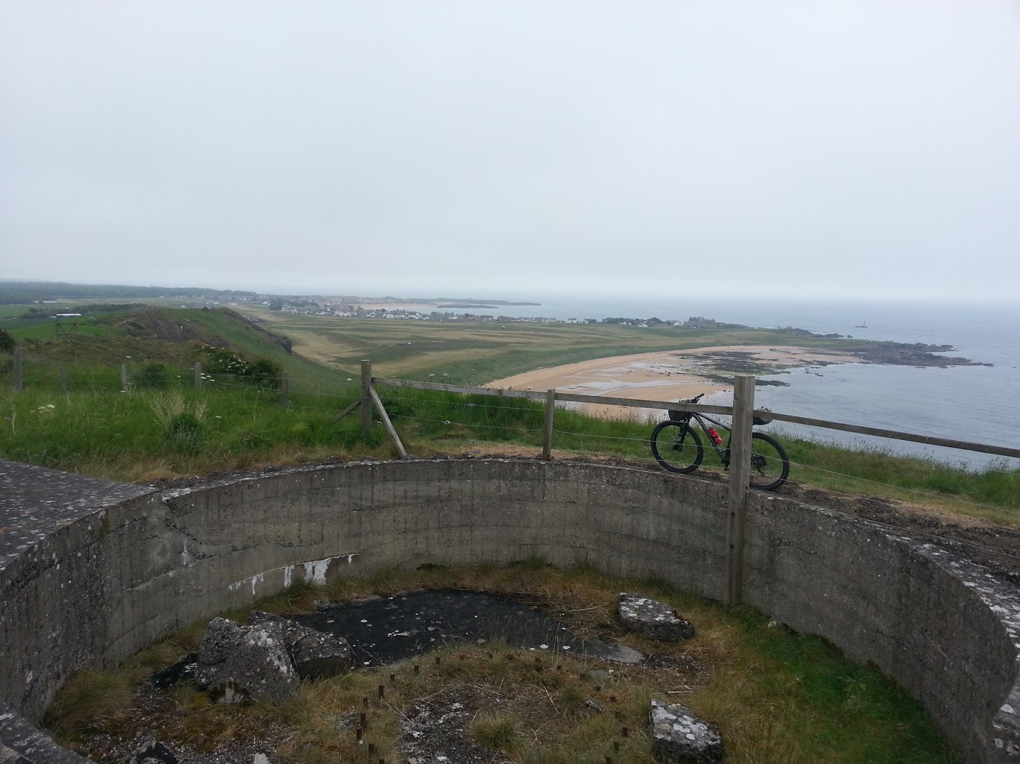
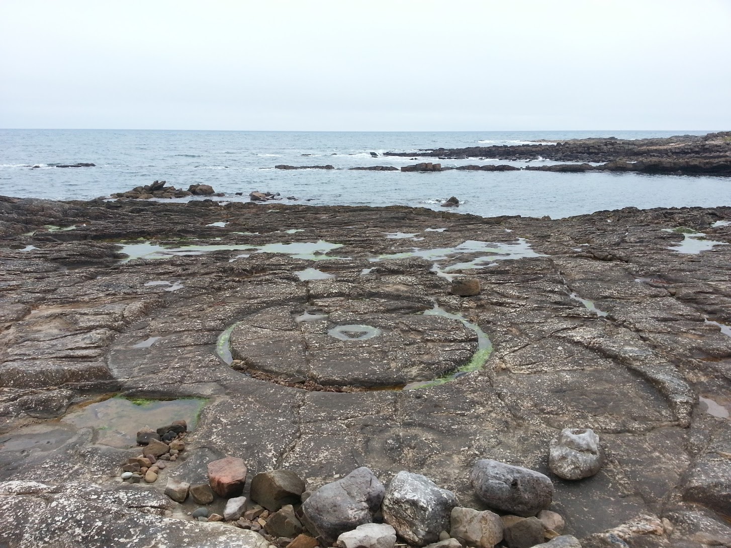
Another static caravan site was passed before reaching a nice section around Kincraig point. A bit of a climb including a few, but not too many, steps led to the top of the rocky cliffs making up the headland. Here there is a few circular structures made of concrete and brick. These are the remains of a WW2 6-inch gun battery. They protected the Firth of Forth from possible incursions by enemy boats. The sandy, flat, beaches along this coast meant that it was considered a possible landing site if the Germans decided to mount an invasion. At the highest point there was also the visible remains of an accommodation camp and radar station.
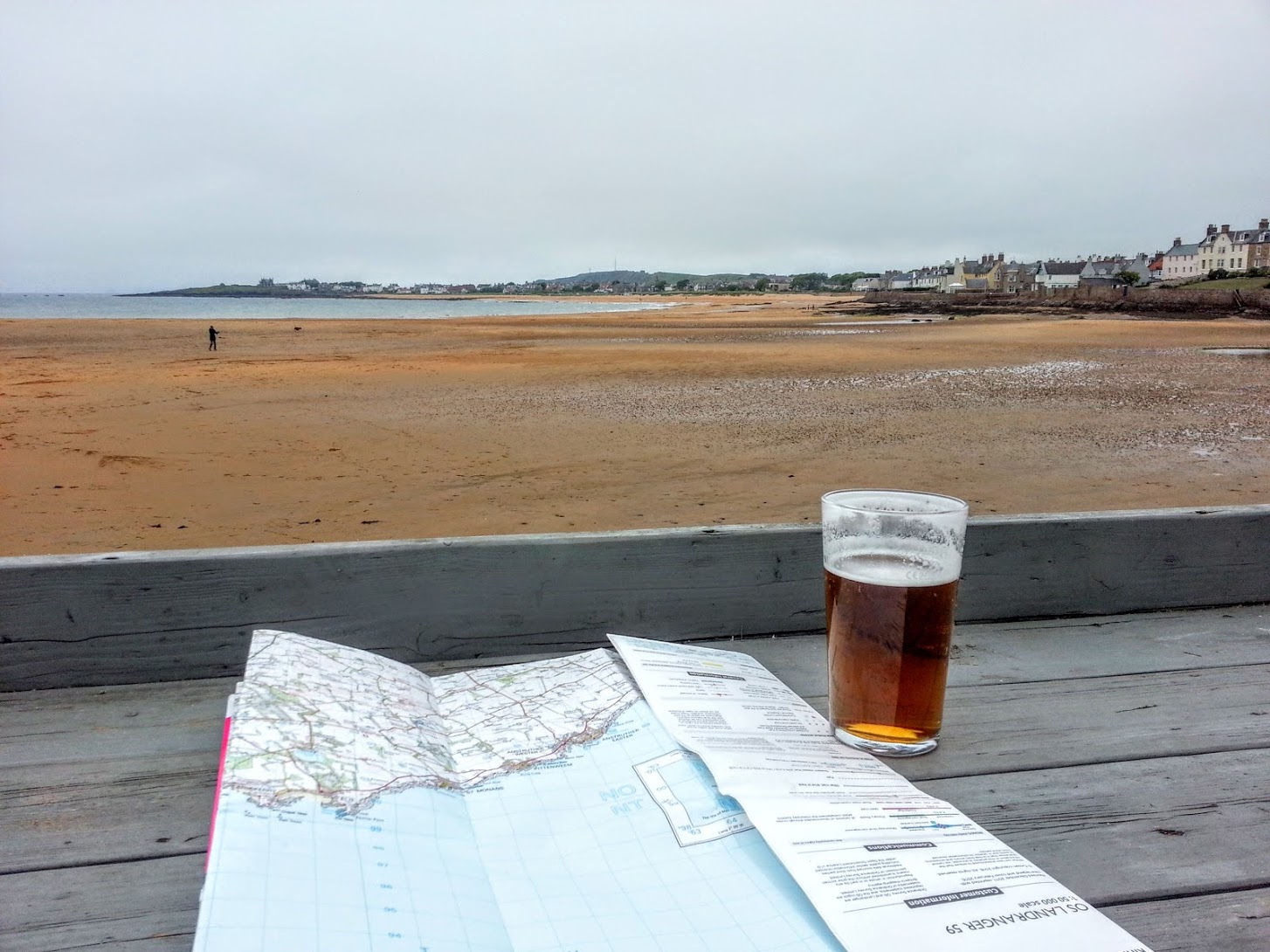
A steep and fun downhill (apart from a load of steps at a certain point) took me back down to the level of the coast and a lovely view of the town of Elie. I scooted through the main street before following a sign pointing down towards the harbour. A pub with a nice beer-garden overlooking the beach was too nice a proposition to pass up on. It was now late afternoon and I'd basically been cycling without much of a rest all day. I bought a beer and sat for a while enjoying the view, examining the map, drinking and eating snacks from my backpack.

Refreshed and a happily woozy from the pint, I carried on along the coast's edge for three kilometres of easy riding.
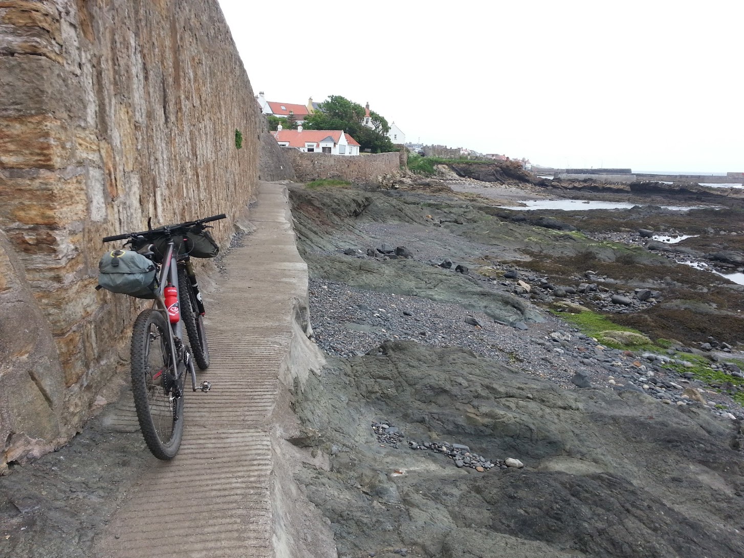
Arriving at the edge of the tiny town of St Monans the path led right down to the water and along a thin concrete walkway with a wall to one side. Careful cycling got me to the other end without incident. Although I was surprised to then find a steep cobbled embankment with cut out foot-holes which I'd need to climb to get up to the street above. Rolling my bike up the wall, rather than try to carry it, I perilously climbed one step before pushing the bike forwards and applying the brakes. Repeating the process 10 or so times got me to the top. I found it was a town of old fishermen and merchant's houses. At the harbour I found the 'old smoke-house' which a friend had recommended I visit. Apparently they smoke not only fish, but a whole range of things including beetroot and chocolate. It was closed.
The harbour here was much larger than those I'd seen in the previous towns, although it was no less pretty, backed by colourful houses stretching along the front.
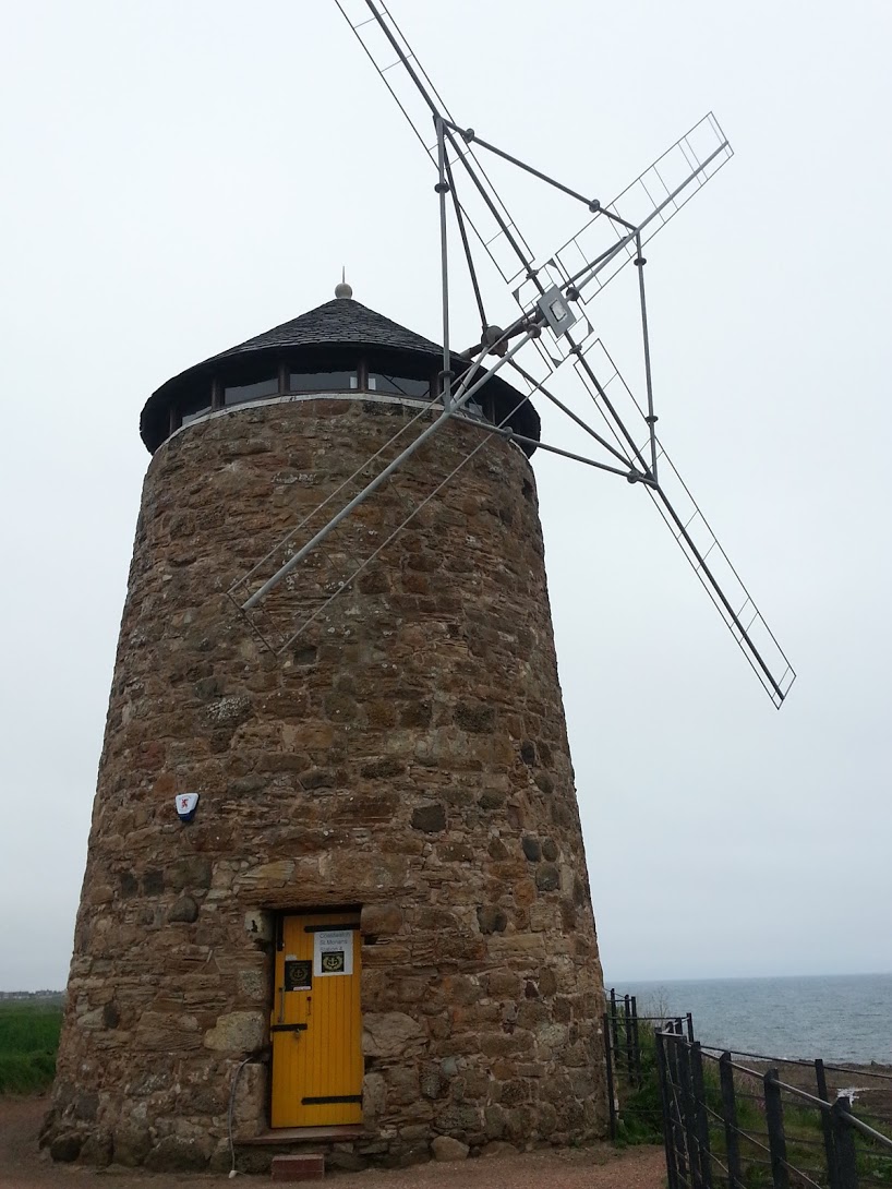
A gravel path took me out of town where I found a well preserved windmill perched on a small hill above the water. This is another remnant of the salt industry. The mill powered pumps which moved sea water into salt pans housed in nine buildings which were on the shore. Coal which was mined nearby was used to heat the pans resulting in the production of salt. The pans were worked 24 hours a day and employed some 20 men. The value of salt at the time is telling, it required eight tons of coal to produce each ton of salt. Tax changes in 1823 killed the industry. Mined rock salt from the south of England was then much cheaper to produce and so the market fell out of sea salt.
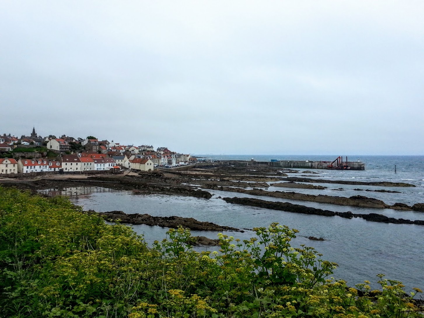
A little further along the coast I arrived at the edge of Pittenweem.
The view of the town from the path was amazing, pretty, red roofed, white houses stretched along the sea front and backed up a hill topped with a fat church spire. The rocks formations emerging from a small sandy beach stood out of the water in front of the town and fanned out in geological lines stretching for a hundred meters out to sea. The style and architectural features of the houses was influenced by trade from Belgium and the Netherlands. The red roof tiles were made from slabs of red rock the ships arriving from the south used as ballast. I found there were lots of steps here to be negotiated, taking me down from the path to the road along the seafront. At least I was going down, unlike the two red faced breathless cyclists carrying their bikes in the opposite direction.
This town, at least the part I saw from the coast, is the very definition of quaint. A car-less passage led along the front, complete with sea themed decorations on the houses such as old bikes adorned with shells and old life-rings hanging from walls. The small harbour looked quite active. Lobster creels were piled high along any spare spaces on the harbour walls. Small brightly coloured boats lay on trailers near to ramps leading into the water. The name of this town derives from the Galic for 'place of the caves'.
A quick cycle around the edge of a golf course, took me to the larger town of Anstruther. This was a much busier town, the sea front being lined with shops and restaurants. I didn't stop to explore the cobbled streets leading away from the sea, instead choosing to continue along the front. I considered stopping for some food as I was beginning to feel hungry, but it was quite busy. I hoped to find somewhere further along the coast.
A grassy path took me for the next couple of kilometres, where I found some strange rock formations standing proud of the surrounding ground. Taking a closer look, I realised that the formations weren't individuals but an interlinked series of caves. Presumably formed in the past by the action of waves. These were the Caves of Caiplie, or Cailpie Coves. At various points they were used for Christian worship, the caves being extended and carved out further by human hand. Crosses could still be seen carved into the walls. At one point a hermit lived in one of the caves for a period, building a wooden wall and front door at the cave entrance. He even installed a window from which to enjoy the view.
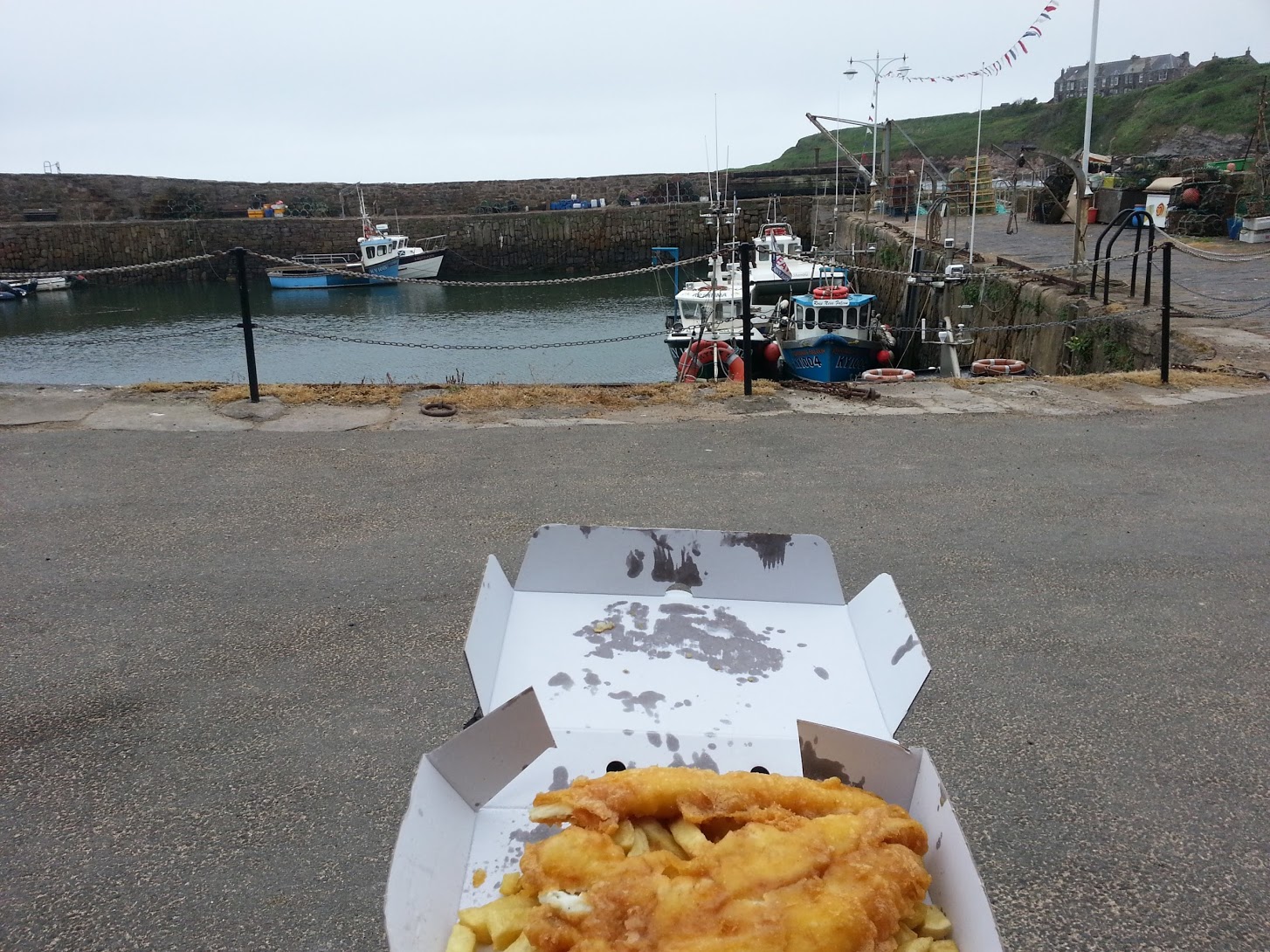
Looking at the map, the nearby, small town of Crail looked like it would provided my last opportunity to buy food. A quick stop at the co-op to buy some supplies and refill my bike bottles with water. Then I found a nearby fish and chip shop. It was quiet and soon I was in the possession of a fantastic smelling, and hot, cardboard box. I carefully carried my precious acquisition in one hand on my bike while gently braking with the other hand and rolling down towards the harbour. I found it quiet, apart from some people setting up some gazebos and tents for some kind of small event presumably taking place the next day. As they pottered about I ate my food on a bench overlooking the water.
A small fishing boat made it's way into the harbour. The boatman tied it to a buoy and then rowed his way to the harbour wall in an even smaller boat. After climbing up the rusting ladder he went behind a shed before re-emerging riding past me on a knackered old bike. “Smells good” he commented in gruff voice.
A bit too full and very slightly rested, it was time to go. I wanted to take a quick look around before continuing along the coastal path. On the other end of the harbour I found the “Crail Lobster Hut”. It was also closed, but I made a mental note to come back sometime (opens 11-4pm everyday apart from Mondays according to the sign on the front). A small concrete lobster reservoir sat just outside the hut. On it was an old enamel sign which read “Warning, do not touch the lobsters”.
I climbed back up the hill and took a quick tour of the town. I found a towered tollbooth in the middle of the town. The design of the turret looked distinctly European with flared curves and overhanging roof sections rather than the plain no-nonsense straight edges of most Scottish towers. Further through the town I came to a pottery shop (also closed). Through a carved hole in the door I could see a courtyard with some examples of the work sitting on shelves inside.
Passing out of the town via a road through the middle of another static caravan park, I passed a disused airfield. This is supposedly the best preserved abandoned airfield in Scotland. A whole range of WW2 buildings remain including a hospital and hangars. It was also the site of a torpedo trainer building where lights and projectors were used inside a dome painted with sky and sea to simulate attack flights. Instructors could control the ship and make evasive manoeuvres while pilots would practice using the equipment necessary to drop a torpedo at the correct altitude and moment.
I passed around the easternmost point of fife and turned to follow the coast north-westwards.
Maybe it was just the lateness of the day, or possibly it was the change in direction, but the wind picked up and the warm humidity of the day soon dissipated. The path followed the edge of endless golf courses. It didn't pass my notice that a nice flat green would make a great spot to put my tent.
There were no more towns along this section of coast. It was nice to end the day with a few solid miles of cycling along slow paths while keeping an eye out for a decent spot to stop for the night.
At Cambo I passed through a woodland and found myself on a track leading around yet another golf course. There was a small toilet building. I tried the door, it was open. Before moving on, I gave myself a quick wash using the very nice smelling soap from the fancy dispensers and enjoyed the heat of the hand driers.
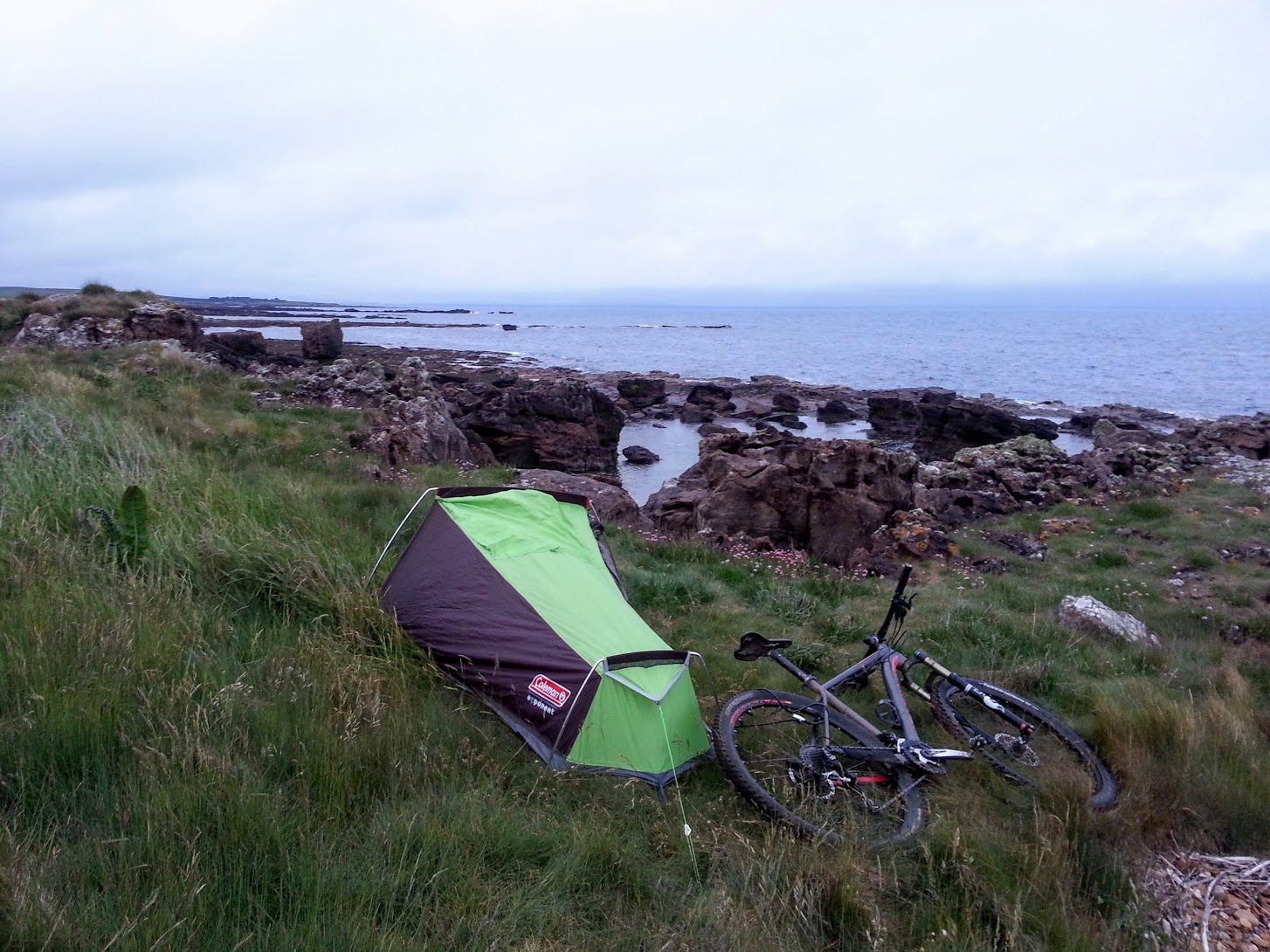
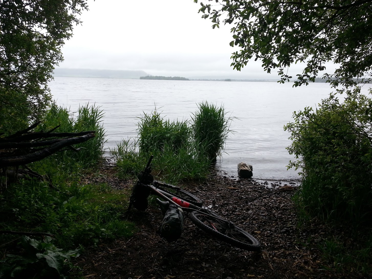
I took to the sandy beach again at Airbow point. This time the sand was softer and progress was slow. Once off the beach I found a suitable spot for camping near Babbet Ness. A small, but flat raised area looked good. After disgorging my luggage onto the heather, I realised the area was infested with snails. Not wanting to crush them, or have sticky slime all over the underside of my tent, I spent the next ten minutes moving maybe a hundred of the little monsters off to one side of where I intended to set up the tent.

Soon I was all setup. It started to rain, so I dived into the tent and changed out of my cycling stuff into some spare, more comfortable clothes while watching the rain bouncing off the sea below. I was knackered. It had been a long day. Almost 13 hours of travelling. I didn't feel like eating anything more, I was still full from the fish and chips earlier, but I set up my stove and boiled some water to make a hot chocolate. Soon I was asleep with the door of the tent wide open. I think it was about 9.30ish.
I woke early the next morning. I was packed and ready to go by 6.30am. I wanted an early start to ensure I didn't get back to Edinburgh too late in the day. Making my way along the sea at this time in the morning was wonderful. Birds flitted along the shore. The early fog provided an eerie, otherworldly feel. It was cold so I was glad to get moving.
I'd camped only about ten kilometres from St Andrews, my final coastal destination. I hoped to stop here for some breakfast.
Just a kilometre on from where I'd stopped for the night, the coastal trail headed inland at Boarhills. I followed the signposts up a wooded river, and crossed a footbridge further up the valley. From here a signpost pointed back towards the coast. However, I'd read from an old account of someone cycling this section of the coast (without heavy overnight equipment) that the next section was a rocky nightmare of carrying and slippery, leg breaking, terrain. So, for the first time on this adventure, I abandoned the Coastal trail and took to the road. It was very quiet as I cycled along in the still present, indeed thickening, fog. I switched on my back light to make myself at least a little more visible and switched into a low gear for pedalling along the easy road. A few cars and a tractor passed. I was surprised that anyone was about at this early hour.
I cycled down a hill and into town. It wasn't yet 8am. I investigated the waterfront, taking a look at the cathedral and castle. There were plenty of rabbits and seagull around, but nothing much was happening. I couldn't find any open cafés. So, after going in a few circles trying to find the correct route out of town, I eventually found a sign for Cycle Route 1, which I knew would take me back to Edinburgh.
Route 1 was fine, but a bit dull after the interesting coastline. It took me along quiet roads and through some nice little towns. Falkland in particular was of note. It was very picturesque with it's myriad of old buildings, many of which were restored in the late 19th century by a wealthy landlord. In fact it was made Scotland's first conservation town in 1970. The town is dominated both by the nearby Lomond hills, which rear up not far away, and the imposing turrets of Falkland palace.
I stopped a few kilometres outside Falkland at the excellent 'Pillars of Hercules' organic farm café for breakfast. The coffee and eggs on toast tasted particularly good after riding so far along roads in the drizzle.
Only a couple of other parts of the route are worth mentioning; the path around Loch Leven was great, and it was a relief to be off of the road for a while. The other good section was the steep climb up the hills near Loch Glow and then the ride through Blairadam forest. Otherwise, the route simply did it's job of getting me back to Edinburgh on some quiet-ish roads. If I was to do the trip again I might investigate cycling back along the coastal cycle route instead.